One of the great things about OpenCPN is the ability to modify (or hack) it to your liking. The problem is that there is really not much documentation on how to do it except the brief instructions on vector palette on OpenCPN manual. Below are instructions on how to change the outlook of oeSENC (S-57) charts. oeSENC charts are available from o-charts.org.
How OpenCPN shows the vector maps is defined by a few files. I am only going to talk about chartsymbols.xml which can be found on Linux at /usr/share/opencpn/s57data folder.
Below are the changes I have made. Please note that with every OpenCPN update, the chartsymbols.xml will be overwritten, so you need to copy your file for example as chartsymbols.xml.own and then replace chartsymbols.xml after the update with your own file.
Changing deep water color to white
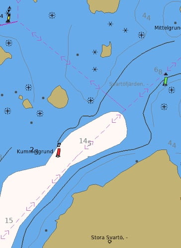
For more unified look with the chart plotters, I wanted the deep water to be white (whitewater).
Original
<color name="DEPDW" r="212" g="234" b="238"/>changed to
<color name="DEPDW" r="255" g="249" b="245"/>Changing boat routes from gray to dark pink
For better visibility, I wanted the boat routes (they are called non-regulated recommended tracks (RECTRC) in OpenCPN) to be dark pink (which is also what Navionics Boating app uses) instead or gray.
You can do it by changing all <color-ref> entries for RECTRC (i.e. RECTRC09, RECTRC10, RECTRC11 and RECTRC12) from CHGRD to CHMGD. These can be found under <line-style> element (see example below, note that the color has already been changed here)
<line-style RCID="3336">
	<name>RECTRC09</name>
	<vector width="2220" height="310">
		<distance min="0" max="0" />
			<pivot x="932" y="1415" />
			<origin x="1107" y="1260" />
	</vector>
	<description>non-regulated recommended two-way track, not based on fixed marks</description>	<HPGL>SPA;SW1;PU1107,1415;PD1423,1415;SPA;SW1;PU1596,1415;PD1921,1415;SPA;SW1;PU2299,1415;PD2624,1415;SPA;SW1;PU3002,1415;PD3327,1415;SPA;SW1;PU2299,1570;PD2094,1415;PD2299,1260;SPA;SW1;PU2624,1570;PD2829,1415;PD2624,1260;</HPGL>
	<color-ref>ACHMGD</color-ref>
</line-style>
Changing boat route orientation texts from black to gray
To reduce the clutter, I have changed the boat route orientation texts (degrees) from black (CHBLK) to gray (CHGRD).
Original (please note that on the file, these are not grouped together like this, see example of the actual file below)
<instruction>LC(RECTRC09);TE('%03.0lf deg','ORIENT',3,1,2,'15110',1,-1,CHBLK,11)</instruction>
<instruction>LC(RECTRC11);TE('%03.0lf deg','ORIENT',3,1,2,'15110',1,-1,CHBLK,11)</instruction>
<instruction>LC(RECTRC11);TE('%03.0lf deg','ORIENT',3,1,2,'15110',1,-1,CHBLK,11)</instruction>
<instruction>LC(RECTRC11);TE('%03.0lf deg','ORIENT',3,1,2,'15110',1,-1,CHBLK,11)</instruction>
<instruction>LC(RECTRC09);TE('%03.0lf deg','ORIENT',3,1,2,'15110',1,-1,CHBLK,11)</instruction>
changed to
<instruction>LC(RECTRC09);TE('%03.0lf deg','ORIENT',3,1,2,'15110',1,-1,CHGRD,11)</instruction>
<instruction>LC(RECTRC11);TE('%03.0lf deg','ORIENT',3,1,2,'15110',1,-1,CHGRD,11)</instruction>
<instruction>LC(RECTRC11);TE('%03.0lf deg','ORIENT',3,1,2,'15110',1,-1,CHGRD,11)</instruction>
<instruction>LC(RECTRC11);TE('%03.0lf deg','ORIENT',3,1,2,'15110',1,-1,CHGRD,11)</instruction>
<instruction>LC(RECTRC09);TE('%03.0lf deg','ORIENT',3,1,2,'15110',1,-1,CHGRD,11)</instruction>
Example of where these can be found is below
<lookup id="820" RCID="31896" name="RECTRC">
	<type>Line</type>
	<disp-prio>Area Symbol</disp-prio>
	<radar-prio>On Top</radar-prio>
	<table-name>Lines</table-name>
	<attrib-code index="0">CATTRK2</attrib-code>
	<attrib-code index="1">TRAFIC4</attrib-code>
	<instruction>LC(RECTRC09);TE('%03.0lf deg','ORIENT',3,1,2,'15110',1,-1,CHGRD,11)</instruction>
	<display-cat>Standard</display-cat>
	<comment>25020</comment>
</lookup>
Hiding underwater cables and pipelines
Underwater cables and pipelines clutter the chart considerably. They are basically only useful when anchoring or doing certain types of fishing (e.g. trawling), but in all other cases, they make reading the map slower. They can be hidden from “User standard” view, but there are always shown on “All” view. Therefore, if you are not doing any anchoring or have an additional chart plotter which shows the cables, it may make sense hiding them permanently on OpenCPN. You can also change the color of these, but the problem is that the water color on the chart varies based on the depth, so these will always stand out on some depth and also in night mode.
To do that, change symbol CBLSUB to CBLSUB_DISABLED and PIPSOL to PIPSOL_SISABLED
Original (please note that on the file, these are not grouped together like this, see example of the actual file below)
<lookup id="709" RCID="31785" name="CBLSUB">
<lookup id="710" RCID="31786" name="CBLSUB">
<lookup id="785" RCID="31861" name="PIPSOL">
<lookup id="786" RCID="31862" name="PIPSOL">
<lookup id="787" RCID="31863" name="PIPSOL">
<lookup id="788" RCID="31864" name="PIPSOL">
<lookup id="789" RCID="31865" name="PIPSOL">
<lookup id="790" RCID="31866" name="PIPSOL">
changed to
<lookup id="709" RCID="31785" name="CBLSUB_DISABLED">
<lookup id="710" RCID="31786" name="CBLSUB_DISABLED">
<lookup id="785" RCID="31861" name="PIPSOL_DISABLED">
<lookup id="786" RCID="31862" name="PIPSOL_DISABLED">
<lookup id="787" RCID="31863" name="PIPSOL_DISABLED">
<lookup id="788" RCID="31864" name="PIPSOL_DISABLED">
<lookup id="789" RCID="31865" name="PIPSOL_DISABLED">
<lookup id="790" RCID="31866" name="PIPSOL_DISABLED">
Example of where these can be found is below
<lookup id="709" RCID="31785" name="CBLSUB_DISABLED">
	<type>Line</type>
	<disp-prio>Area Symbol</disp-prio>
	<radar-prio>On Top</radar-prio>
	<table-name>Lines</table-name>
	<attrib-code index="0">CATCBL6</attrib-code>
	<instruction>LS(DASH,1,CHMGD)</instruction>
	<display-cat>Standard</display-cat>
	<comment>24010</comment>
</lookup>
I am sure there are numerous other things you can change to make oeSENC maps better suited for your taste. The different object acronyms for S-57 ENC charts can be found here.